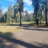
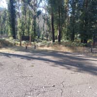
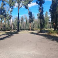
Bailes Camping Area


Features
Popular
-
Toilets

-
Allows fires

Popular
-
Pets Allowed

-
Free

-
Toilets
-
Drinking Water

-
BBQ Areas

-
Powered sites

-
Showers

-
Swimming

-
Allows fires
Activities
-
Water slide

-
Biking

-
Hiking

-
Fishing

-
Walking Trails

-
4WD Trails

-
Bar

Type
-
Next to car

-
Allotted Site

-
Short walk to car

-
Caravans

-
Camper Trailers

-
Glamping

-
Cabins Available

-
Pub

For Kids
-
Jumping pillow

-
Horse riding

-
Kids play park

-
Organised kids activities

-
TAWK Supporters

Ownership
-
National Parks

-
State Forest

-
Independent

-
BIG4

-
Kui Parks

-
Aspen Parks

-
Discovery Holiday Parks

-
Family Parks

-
Reflections

-
Top Parks

-
NRMA

-
Holiday Haven

-
Ingenia

Access
-
Hike in

-
Car

-
4WD only

-
Disabled Access

Other
-
Firewood for sale

-
Boat Ramp Nearby

-
Wifi

-
Phone Reception

-
Dump Spot

-
Garbage

-
Swimming pool

-
Water (Non Drinking)

-
Laundry

-
Coffee Nearby

-
Boat Cleaning Facilities

-
Cafe onsite

-
4WD beach driving

-
Pyrenees Caravan Park
3 Ratings
Pets Allowed
Drinking Water
BBQ Areas
Powered sites
16.1 km's away
$999 -
Golden Country Motel & Caravan Park
0 Ratings
Pets Allowed
Drinking Water
BBQ Areas
Powered sites
Swimming
34.1 km's away
$65 -
Creswick Holiday Park
2 Ratings
Pets Allowed
Drinking Water
BBQ Areas
Powered sites
Showers
36.6 km's away
$52 -
Eureka Stockade Holiday Park
4 Ratings
Pets Allowed
Drinking Water
BBQ Areas
Powered sites
Swimming
39.5 km's away
$69 -
Breeze Holiday Parks - Grampians
11 Ratings
Pets Allowed
Drinking Water
BBQ Areas
Powered sites
Showers
Swimming
40.5 km's away
$56
1 Review

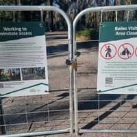
The Bailes campground & sites are closed until further notice unfortunately, due to large bushfires in Feb 2024. We did NOT camp here. It's not safe to walk around & look in this area, it is fenced &... Read more

Location
643 Ferntree Gully Road,
Raglan,
Victoria
/143.237617,-37.313903,9,0/300x200?access_token=pk.eyJ1IjoiYWlyY2FtcGF1IiwiYSI6ImNqdTg0aXZzNTIxYzEzeW9iN25xaG51eWQifQ.erq2STwV0mFKkODqqk7gPg&attribution=false)
Details
- Listing type
- Campsite
- Caravans
- Yes
- Management
- National Parks
- Website
- Visit
Average temperature
Closest
Chargefox (standard)
67.92 kmScotts Beaufort
24.51 kmCanoeing
144.37 kmMyrnong Beach
201.69 kmRelated lists
-
Top 10 National Park campgrounds near Beaufort, VIC
Australia has some of the most beautiful national parks in the world. Here are our favourite 10 national park campgrounds near Beaufort, VIC.
-
Top 10 National Park campgrounds near Smythesdale, VIC
Australia has some of the most beautiful national parks in the world. Here are our favourite 10 national park campgrounds near Smythesdale, VIC.
-
Top 10 National Park campgrounds near Haddon, VIC
Australia has some of the most beautiful national parks in the world. Here are our favourite 10 national park campgrounds near Haddon, VIC.
- The top 10 warmest campsites in QLD for February
Nearby locations
Nearby campsites
-
Ferntree Camping Area
Off Ferntree Gully Rd, RAGLAN, Victoria
-
Middle Creek Camping Area
620-636 Ferntree Gully Road, Raglan, Victoria
-
Beeripmo Walk Camp
Beeripmo Walk, Raglan, Victoria
-
Laura's Mount Sugarloaf Circuit Camp
Beeripmo Walk, Raglan, Victoria
-
Mugwamp Camp Area
Mugwamp Track See Web Site For Detailed Map, Victoria
-
Ditchfields Camp Area
Raglan-Mount Cole Road, Raglan, Victoria
